08/04/2021
Digital
Can we stop debris from threatening the future of space travel?
The number of satellites and debris in Earth’s orbit is growing rapidly, so is our reliance on satellite generated data. To keep space fit for use and protect our critical national infrastructure, we worked with the UK Space Agency to prevent collisions.
On the 10 February 2009, an active Iridium communications satellite and an inactive Russian military satellite collided at 11.7 km/s 800 km above Siberia. The collision created thousands of fragments of debris, and likely millions of additional pieces too small to monitor, which are still congesting Earth’s orbit today. It would only take a few more incidents like this to render the majority of near-Earth space unusable.
To make sure that we’re able to continue to use our orbit for years to come for everything from satellites to space missions, getting better at understanding and preventing collisions is vital. We worked with the UK Space Agency to create and test a prototype for satellite operators and government to monitor and prevent collisions between objects in orbit.
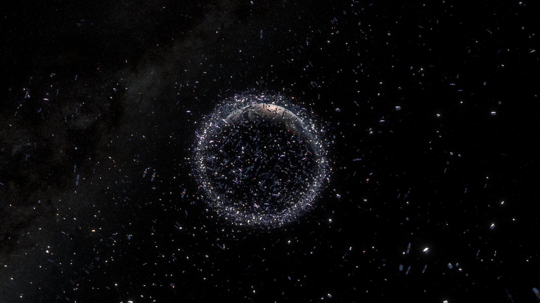
Space is filling up
Since 4 October 1957 when the first man-made object to enter Earth’s orbit was launched, Sputnik-1, the number of active satellites in orbit has grown to over four thousand. This number is only set to grow, especially with the increase of mega-constellations such as Starlink and OneWeb which may involve hundreds, if not thousands, of satellites.
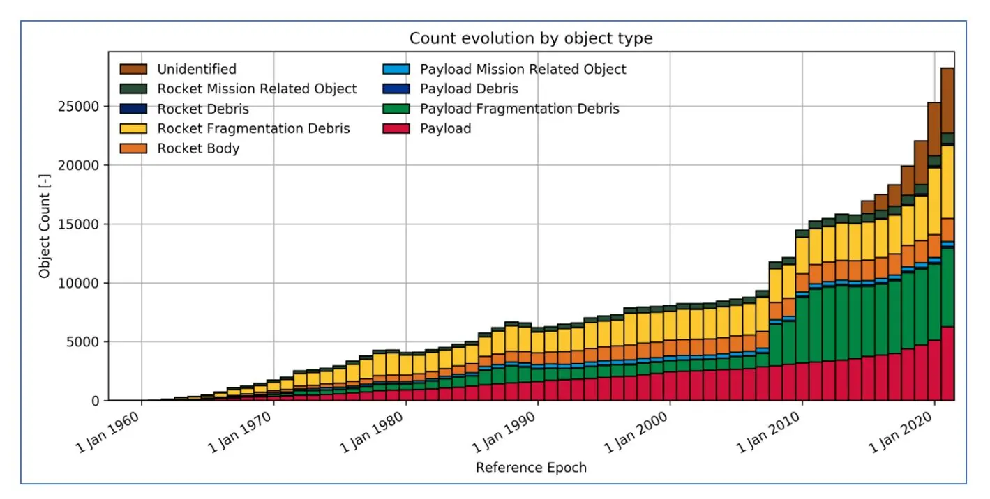
And that doesn’t even account for the debris… There are estimated to be about 34,000 objects in the Earth’s orbit greater than 10cm in length and 128 million greater than 1mm (as shown in the object count below). Space debris refers to objects left in space by humans which can be anything from a whole unused satellite to something much smaller like unburned particles from a rocket motor. With the amount of debris increasing rapidly, collisions are, of course, becoming more likely.
A collision is a global problem
A collision between a satellite and another object can be catastrophic. Even the smallest pieces of debris can cause huge damage when flying at a satellite at several kilometres a second. Satellites are expensive to build, launch and operate. Often the process of planning a mission will take years or decades and so launching your satellite only for it to be damaged or destroyed in a collision would be more than disappointing.
As with the Iridium crash in 2009, when a collision occurs, it creates a cloud of thousands of debris fragments that spread out across the environment, creating chaos for other satellites and reducing the area of clean orbits for new satellites.
Due to the knock-on effects of collisions for future space use, this is a global problem. Operators are expected to avoid collisions and can be liable for any damaged caused. International guidelines state: operators must “prevent in-space crashes through careful choice of orbits and by performing ‘collision avoidance manoeuvres’”. In fact, international law states that the launching state is “absolutely liable to pay compensation for damage caused by its space objects”. Therefore, preventing collisions is well within the interests of operators and the UKSA.
How can we help operators prevent collisions?
Manoeuvring a satellite is no easy task. It is time-consuming, complex and expensive. Therefore, satellite operators need more data and, specifically, more high-quality data in order to inform their decisions and to ensure they can conduct accurate and effective manoeuvres.
To support satellite operators, the UKSA asked us to research and design a prototype for a web-based product that ingests space surveillance and tracking data and presents it to the user in a clear and easy-to-understand format. This product could inform users about conjunction events, notify them about upcoming risks and provide them with both UKSA generated analysis and data from other organisations.
To do this, we interviewed 75% of UK satellite operators to understand their needs and preferences for a product. We learnt that it was vital for operators to not only have access to high quality data, but also information on data sources and how the data was generated. We integrated the needs of the operators into our prototype and evaluated the feasibility of the product by developing the technical architecture that would support the service. This included investigating existing data flows, conducting an options analysis of possible technical architecture options and generating a data catalogue specifying where data would be sourced.
Using the GOV.UK prototype kit, we created and developed our prototype. We continuously iterated the interfaces to take on board our latest user feedback. We tested the interfaces with potential users and conducted a simulation exercise with students at Cranfield University to help us further investigate the usability of the product. After 70+ hours of user research, we had thoroughly tested user interfaces that operators believed would facilitate their ability to safely and reliably operate their satellites.
The future of space exploration hangs in the balance
The future of space exploration relies upon the safe and responsible activity of satellite operators and regulating bodies now. With increasing activity in Earth’s orbit and increasing demand for services and research requiring satellites, we must take responsibility for our activity and ensure we use space in a sustainable way. This means minimising the generation of new space debris, preventing the collision of satellites and even reducing the amount of existing debris.
The future looks bright. You may have heard about Astroscale’s ELSA-d programme which launched last week. With the aim of conducting space-debris removal demonstrations, this mission could open the doors to cleaning up our near-Earth space and ensuring that future generations will continue to be able to access and utilise it.
Developing software that provides extra collision avoidance support to operators will play an important role in ensuring the future of space exploration. Just last month, Galileo satellite GSAT0219 conducted a collision avoidance manoeuvre which prevented a catastrophic collision with a large fragment of space debris. The European Space Agency was able to notify and advise the operator using data from their space surveillance and tracking systems. As this shows, warning systems for collisions are effective and help prevent disasters every day.
We were so pleased to work with the UK Space Agency on this project, who have world-leading space surveillance and tracking capabilities.
Author: Sophie Cooper, The PSC Digital Team


Latest News & Insights.

The Next 20: Home First and the future of hospital discharge
Our latest episode of 'The Next 20' sees Chris Bradley speaks with Rachel Kemp…

The Next 20: The Analogue to Digital Shift
Digital transformation in healthcare is not just about technology. In this…

Our APPO Process: How to get real value from AI
AI is exciting, and experimenting with it is the right instinct. But, left…